User login
Language
Anonymous's groups in this site
User is not a member of any group.
Your groups across all your sites
User is not a member of any group.
Recent Content
Who's online
There are currently 0 users online.
You are here
New Storm Surge Forecast Maps Enhanced Preparedness for Hurricane Arthur
Primary tabs
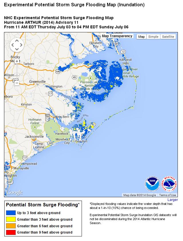
http://www.nhc.noaa.gov/refresh/graphics_at1+shtml/085007.shtml?inundation
The National Hurricane Center’s new maps, released as the storm approached the U.S., predicted the location and severity of the surge
scientificamerican.com - by Kevin Schultz - July 14, 2014
Hurricane Arthur smashed into the North Carolina coast last week. Just before it hit, residents checked a new storm surge map, found on the National Hurricane Center (NHC) Web Site. It showed them whether they would be above the water driven onto land by the storm or need to evacuate to higher ground. Store owners used it to figure out how high they needed to move their goods off the ground to prevent water damage. Some emergency management crews even utilized it to predict where the hardest hit places could be.


Recent Comments