You are here

Disaster Management

Primary tabs

This working group is focused on discussions about disaster management.

The mission of this working group is to focus on discussions about disaster management.

Members

Kathy Gilbeaux Maeryn Obley mdmcdonald

Email address for group

disaster-management@m.resiliencesystem.org

OCHA - Japan: An Earthquake, a Tsunami – and a Handwritten Newspaper


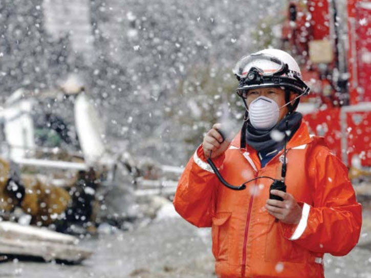
A rescue worker uses a two-way radio transceiver during heavy snowfall at a factory area devastated by an earthquake and tsunami in Sendai, northern Japan, 16 March 2011. Credit: REUTERS/KIM KYUNG-HOON

unocha.org - March 15, 2013

When one of the most technologically sophisticated countries in the world is hit by a triple emergency, should we count on web platforms and social media to deliver lifesaving information? Not necessarily, according to a new report by Internews into the communications aspects of the 2011 earthquake, tsunami and nuclear disaster in Japan.

. . . instead of their usual high-tech operation, local newspaper reporters went back a few decades in time and produced a handwritten newspaper.

(READ COMPLETE ARTICLE)

Internews Report - Connecting the Last Mile: The Role of Communications in the Great East Japan Earthquake
http://www.internews.org/research-publications/connecting-last-mile-role-communications-great-east-japan-earthquake

Country / Region Tags: 
General Topic Tags: 
Problem, Solution, SitRep, or ?: 

Florida County Taps Faith-Based Community for Preparedness

Illustration by Tom McKeith

submitted by Samuel Bendett

emergencymgmt.com - by Lauren Katims - March 11, 2013

Miami-Dade County, Fla., emergency management officials have been praised for their effective preparedness and recovery in a hurricane-and flood-prone area. Now the county is serving as the pilot for a federal program to better engage members of the community who haven’t been as easy to reach.

Communities Organized to Respond in Emergencies (CORE), a program launched by the Department of Homeland Security’s Center for Faith-based and Neighborhood Partnerships, is designed to better engage faith-based and community organizations in planning for, responding to and recovering from disasters.

(READ COMPLETE ARTICLE)

Verily: Crowdsourced Verification for Disaster Response


irevolution.net - by Patrick Meier - February 19, 2013

Social media is increasingly used for communicating during crises. This rise in Big (Crisis) Data means that finding the proverbial needle in the growing haystack of information is becoming a major challenge.

QCRI and Masdar have launched an experimental  platform called Verily. We are applying best practices in time-critical crowd-sourcing coupled with gamification and reputation mechanisms to leverage the good will of (hopefully) thousands of digital Samaritans during disasters.

(READ COMPLETE ARTICLE)

Veri.ly
http://www.veri.ly/

Country / Region Tags: 
Problem, Solution, SitRep, or ?: 

Mississippi Emergency Management Agency (MEMA) Updates Reports from Tornado Damage

(U.S. RESILIENCE SYSTEM MEMBERS ARE ASSISTING WITH RELIEF EFFORTS FOR THIS DISASTER THROUGH THE ADMINISTRATION OF A FACEBOOK PAGE TITLED "HATTIESBURG, MS TORNADO - DO YOUR PART".  CLICK HERE TO GO TO THE "HATTIESBURG, MS TORNADO - DO YOUR PART" FACEBOOK PAGE.)       


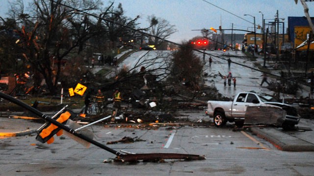
Hardy Street in front of the University of Southern Mississippi campus is obstructed by debris blown by an apparent tornado in Hattiesburg, Miss., Sunday, Feb. 10, 2013. (AP Photo/The Student Printz, Jana Edwards)

hattiesburgamerican.com - February 11, 2013

The Mississippi Emergency Management Agency has received reports of damage from nine counties as a result of severe weather that moved through the state on Sunday.There were at least 63 injuries, two critical and the rest minor. There are no reported deaths.

(READ COMPLETE ARTICLE)

Why 58 Representatives Who Voted for Hurricane Katrina Aid Voted Against Aid for Sandy


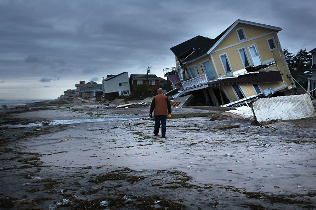
Damage in the Rockaway neighborhood in Queens, N.Y., where the historic boardwalk was washed away during Hurricane Sandy on Oct. 31, 2012. (Spencer Platt/Getty Images)

propublica.org - by Theodoric Meyer - January 18, 2013

When Hurricane Katrina hit in 2005, Congress passed two relief bills almost unanimously. But when it comes to Hurricane Sandy, some in Congress seem to have had a change of heart.

In total, 58 representatives voted against bills this month similar to ones that they had supported after Katrina.

Here's a breakdown of how each of them voted on the two Katrina bills and the two Sandy ones:

(READ COMPLETE ARTICLE)

Far Rockaway: Global Disaster Zone

An emergency clinic in the Far Rockaways. Photo: Michael Goldfarb/Doctors Without Borders \

Image: An emergency clinic in the Far Rockaways. Photo: Michael Goldfarb/Doctors Without Borders

Submitted by Jeanne Heifetz

outsideonline.com - November 8th, 2012 - Matthew Power

On Election Day, a week after Hurricane Sandy had brought the largest city in America shuddering to a halt, there were still lines of cars at gas station stretching for blocks. At polling stations, the lines of voters stretched nearly as far. The Manhattan skyline twinkled with light again, and most of the subway tunnels had been dewatered by the Army Corps of Engineers.

(VIEW COMPLETE ARTICLE)

U.S. Satellite Plans Falter, Imperiling Data on Storms

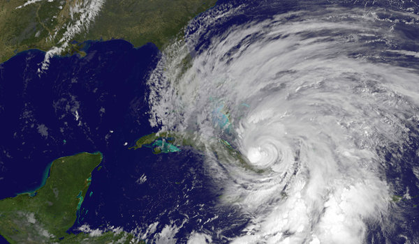
A NASA satellite image shows Hurricane Sandy battering the Caribbean on Thursday.

Image: A NASA satellite image shows Hurricane Sandy battering the Caribbean on Thursday. (Agence France-Presse — Getty Images)

nytimes.com - October 26th, 2012 - John H. Cushman Jr.

The United States is facing a year or more without crucial satellites that provide invaluable data for predicting storm tracks, a result of years of mismanagement, lack of financing and delays in launching replacements, according to several recent official reviews.

 The looming gap in satellite coverage, which some experts view as almost certain within the next few years, could result in shaky forecasts about storms like Hurricane Sandy, which is expected to hit the East Coast early next week.

The endangered satellites fly pole-to-pole orbits and cross the Equator in the afternoon, scanning the entire planet one strip at a time. Along with orbiters on other timetables, they are among the most effective tools used to pin down the paths of major storms about five days ahead.

Google Crisis Map - Superstorm Sandy

http://google.org/crisismap/2012-sandy

Sandy is a major storm, previously a hurricane, that has caused extensive flooding, power and transportation outages, and physical damage to the US East Coast and Caribbean. More than 100 deaths have been linked to the storm.

(GO TO THE SUPERSTORM SANDY GOOGLE CRISIS MAP)

Imagining First Responders’ High-Tech Future

submitted by Samuel Bendett

Homeland Security News Wire - October 5, 2012

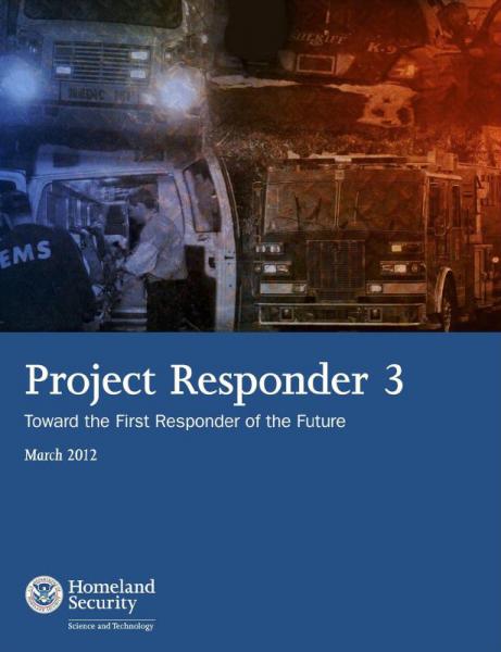
What kinds of gear will be needed by future firefighters, EMTs, and police officers? To find out, DHS asked the department’s research arm to ask the experts, then apply sophisticated math to discover unlikely patterns. The results are detailed in an intriguing report.

(READ COMPLETE ARTICLE)

Project Responder 3: Toward the First Responder of the Future - March 2012 (139 page .PDF file)
http://www.firstresponder.gov/Miscellaneous%20PDFs/ProjectResponder3Report.pdf

New York Unprepared for Flooding, Sea Level Rise

submitted by Samuel Bendett

Homeland Security News Wire - September 24, 2012

City Environmental Justice Alliance told the New York Times. “We’re behind in consciousness-building and disaster planning.”

Officials in New York say that it will take time to adapt a city of eight million people to climate change, and they also note that the last time a hurricane directly hit New York was more than a century ago.

(READ COMPLETE ARTICLE)

Pages

howdy folks
Page loaded in 0.694 seconds.