You are here

Maps - US

Primary tabs

This working group is focused on discussions about maps.

The mission of this working group is to focus on discussions about maps.

Members

Hank Rappaport Kathy Gilbeaux mdmcdonald

Email address for group

maps-us@m.resiliencesystem.org

Thinking About a Holiday Gathering? Look at This Risk Map First

Thinking About a Holiday Gathering? Look at This Troubling Map First

Country / Region Tags: 
Problem, Solution, SitRep, or ?: 

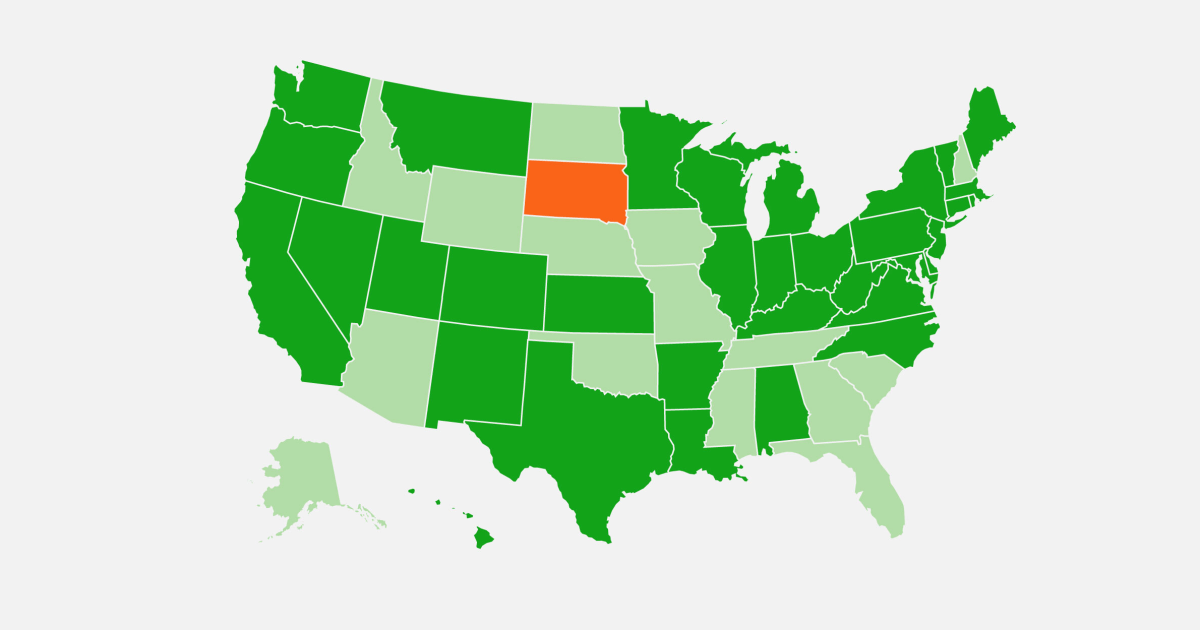
Coronavirus Is Surging: How Severe Is Your State's Outbreak? --Map/graphics

More than 10 million people in the U.S. have had confirmed coronavirus infections and more than 230,000 have died of COVID-19. Tens of thousands of new cases are reported daily nationwide. In the graphics below, explore the trends in your state.

Country / Region Tags: 
Problem, Solution, SitRep, or ?: 

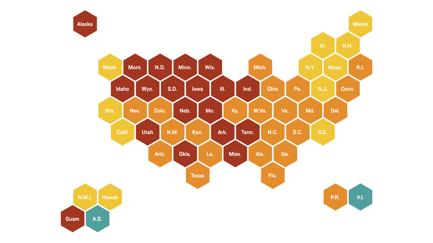
Coronavirus Maps: How Severe Is Your State's Outbreak?--NPR maps

More than 8 million people in the U.S. have had confirmed coronavirus infections and more than 225,000 have died of COVID-19. Tens of thousands of new cases are reported daily nationwide. In the graphics below, explore the trends in your state.

Country / Region Tags: 
Problem, Solution, SitRep, or ?: 

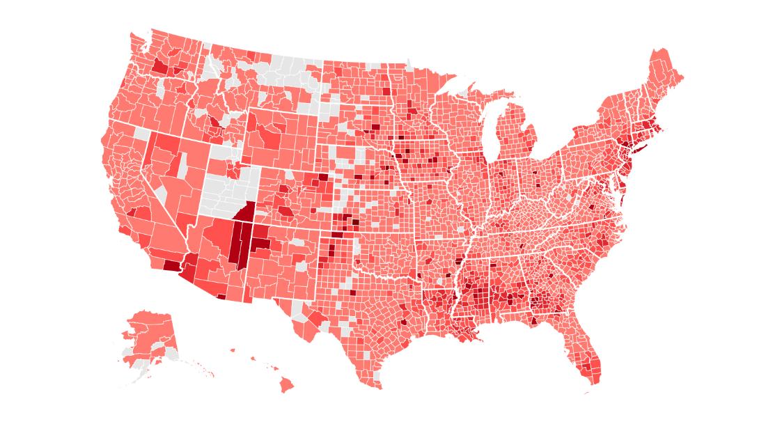
Tracking Covid-19 cases in the US

Country / Region Tags: 
Problem, Solution, SitRep, or ?: 

Map - Global Forest Watch Fires

Map Link
https://fires.globalforestwatch.org/map/#activeLayers=viirsFires%2CactiveFires&activeBasemap=
topo&activeImagery=&planetCategory=PLANET-MONTHLY&planetPeriod=null&x=0.000000&y=40.000000&z=2

fires.globalforestwatch.org

Global Forest Watch Fires (GFW Fires) is an online platform for monitoring and responding to forest and land fires using near real-time information. GFW Fires can empower people to better combat harmful fires before they burn out of control and hold accountable those who may have burned forests illegally.

GFW Fires combines real-time satellite data from NASA’s Active Fires system, high resolution satellite imagery, detailed maps of land cover and concessions for key commodities such as palm oil and wood pulp, weather conditions and air quality data to track fire activity and related impacts in the South East Asia region. GFW Fires also offers on-the-fly analysis to show where fires occur, and help understand who might be responsible.

By working with national and local governments, NGOs, corporations, and individuals, GFW Fires is working to quicken fire response time, ramp up enforcement against illegal fires, help ensure those who are illegally burning are held accountable, and coordinate relationships between government agencies.

(CLICK HERE - READ COMPLETE ARTICLE)


Country / Region Tags: 
Problem, Solution, SitRep, or ?: 

How Flood Control Officials Plan To Fix Area Floodplain Maps

Graphic of Texas shows the updated rainfall values in inches that define certain extreme events, such as the 100-year storm. Courtesy of NOAA

CLICK HERE - ENLARGED TEXAS MAP (1 page .PDF file)

New topographic and predictive rainfall data means more people in Harris County will be mapped in floodplains.

houstonpublicmedia.org - by Davis Land - November 26, 2018

When Hurricane Harvey left so much of Houston underwater, it highlighted a problem that’s been getting worse for years: Harris County’s existing floodplain maps just don’t work.

In the year since the historic storm, flood control officials have promised to change that, and they already had plans to redo the maps, but new data on the geography of the area and the amount of rainfall forecasters expect in the future means the new maps could look drastically different.

It’s crucial the maps are done right, as people are using the maps, meant to set flood insurance premiums, for more than they are intended . . . 

Country / Region Tags: 
Problem, Solution, SitRep, or ?: 

Pages

howdy folks
Page loaded in 0.515 seconds.