Knowledge Science

Primary tabs

The Knowledge Science working group is focused on exploring the advancement of knowledge science.

The mission of the Knowledge Science working group is to explore the advancement of knowledge science.

Members

Joyce Fedeczko Kathy Gilbeaux Maeryn Obley mdmcdonald mike kraft Siftar
tkm tom.mcginn

Email address for group

knowledge-science@m.resiliencesystem.org

Medicine's Mobile Mania Raises the Threat Level, DHS Warns

submitted by Luis Kun

gcn.com - by Kevin McCaney - May 16, 2012

Health care facilities are increasingly going wireless, employing smart phones, tablets and other mobile devices to diagnose and treat patients and make medical records easy to get to. It’s a trend that’s not going to slow down, either.

In fact, Federal Communications Commission Chairman Julius Genachowski is expected May 17 to call for freeing up wireless spectrum to boost another wireless tool, “mobile body area networks,” which allow doctors to remotely monitor patients through the use of sensors and wireless transmissions.

But all that mobile connectivity, along with an array of network-connected devices, comes with risks, particularly since the medical industry isn’t known to be strong on security, as a recent report from the Homeland Security Department points out.

FCC Plans Nationwide Spectrum Grant for Medical Monitoring Networks

submitted by Luis Kun

nationaljournal.com - by Adam Mazmanian - May 17, 2012

Federal Communications Commission chairman Julius Genachowski announced on Thursday that the agency will likely adopt a plan to dedicate a nationwide swath of spectrum to the operation of wireless medical monitoring devices.

Final approval is expected at the FCC’s next open meeting, scheduled for May 24. The spectrum allocation is part of the FCC’s National Broadband Plan.

The move would make the “U.S. the first country in the world to dedicate spectrum for Medical Body Area Networks in hospitals, clinics, and doctors’ offices,” Genachowski said.

(READ COMPLETE ARTICLE)

Video - 2012 Joseph Leiter Lecture - Future Humanitarian Crises: Challenges to Practice, Policy & Public Health

May 9, 2012

The 2012 Joseph Leiter Lecture will be delivered by Dr. Frederick M. Burkle, at 2:00 p.m. on May 9, 2012, in National Library of Medicine's Lister Hill Center Auditorium. The lectureship, which honors former NLM Associate Director for Library Operations, Joseph Leiter, Ph.D., is sponsored jointly by the National Library of Medicine and the Medical Library Association.

Dr. Burkle is senior fellow and scientist, the Harvard Humanitarian Initiative, Harvard School of Public Health, and former senior scholar and now senior associate faculty and research scientist, the Center for Refugee & Disaster Response, Johns Hopkins University Medical Institutes. He also serves as a senior international public policy scholar, Woodrow Wilson Center for International Scholars, Washington, DC (2008-present).

In addition, he serves as adjunct professor, and as a clinical professor of surgery and adjunct professor in tropical medicine, at the University of Hawaii. He is also adjunct professor, Department of Military & Emergency Medicine, Uniformed Services University of Health Sciences, Bethesda, MD, and the Department of Public Health and Tropical Medicine, John Cook University, Australia.

Researchers Use GPS Data to Speed Up Tsunami Warnings


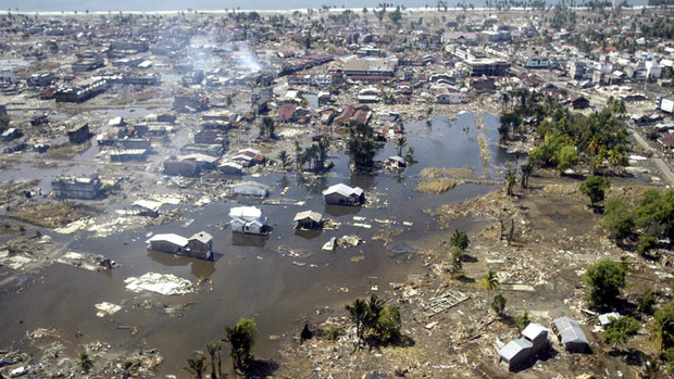
In this Jan. 2, 2005 file photo, a wide area of destruction is shown from an aerial view taken over Meulaboh, 250 kilometers (156 Miles) west of Banda Aceh, Indonesia. Researchers in the United States are hoping to use GPS data to speed up current warnings. (AP Photo/Dita Alangkara, File)

U.S. seismologists currently testing new warning system

by Andrew Pinsent - CBC News - May 5, 2012

Scientists in the United States have been testing an advanced tsunami warning system using GPS data, combined with traditional seismology networks, to attempt to detect the magnitude of an earthquake faster so warnings of potential tsunamis can get out to potentially affected areas sooner.

The prototype is called California Integrated Seismic Network (CISN), and is a collaboration between the United States Geological Survey (USGS) and The Gordon and Betty Moore Foundation, whose focus is on environmental conservation.

Country / Region Tags: 
Problem, Solution, SitRep, or ?: 

The City as Lab: 21 Metropoles Prepare to Prototype

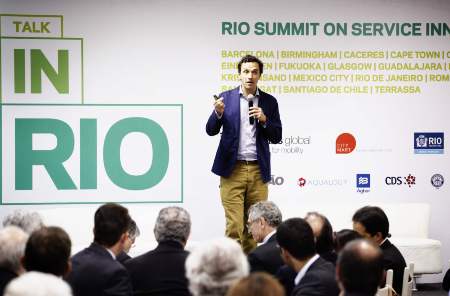
Living Labs Global co-founder Sascha Haselmayer addresses the crowd in Rio de Janeiro

submitted by Albert Gomez

good.is - by Zak Stone - May 4, 2012

In a megapolis like Mexico City, any planning initiative that moves citizens from cars to busses will pay off in reductions to traffic and air pollution. A major deterrent to using public transportation in the city? Comfort, according to Dr. Julio Mendoza, director of Mexico City's Institute of Science and Technology. Many would rather drive than experience that particular breed of public transportation-pegged anxiety: waiting helplessly on the street corner for a bus that feels like it won't ever arrive.

After participating in the Living Labs Global Award program, a competition designed to help cities solve planning challenges, the Mexican capital may have found a fix. In February, Mexico City and 20 other LLGA participants around the world put out an open call to companies to pitch solutions to important but fixable problems.

Country / Region Tags: 
Problem, Solution, SitRep, or ?: 

Journals - Disaster Medicine

submitted by Tim Siftar

Disaster Medicine & Public Health Preparedness ISSN: 1935-7893

http://www.dmphp.org/
 

Internet journal of rescue and disaster medicine 1531-2992

http://www.ispub.com/journal/the-internet-journal-of-rescue-and-disaster-medicine/
 

Prehospital and disaster medicine 1049-023X

http://journals.cambridge.org/action/displayJournal?jid=PDM


Future Trends in Geospatial Information Management: The Five to Ten Year Vision

submitted by Samuel Bendett

United Nations Initiative on Global Geospatial Information Management - April 24, 2012

A working group was established to assess the future trends in geospatial information management at the 1st meeting of the UN Committee on GGIM in Seoul, Korea. Chaired by Dr. Vanessa Lawrence, Director General and Chief Executive of Ordnance Survey, the working group has received written inputs from 29 persons or institutions. A summary of the future trends shall be presented during this forum in Amsterdam, followed by discussion among all the participants. Meanwhile, the process of soliciting views on future trends continue and the working group welcomes any additional inputs. A consolidated paper on the future trends shall be discussed in the 2nd Session of the Committee of Experts on Global Geospatial Information Management.

http://ggim.un.org/

Background paper:
Future trends in geospatial information management: the five to ten year vision (8 page .PDF file)


Country / Region Tags: 
General Topic Tags: 
Problem, Solution, SitRep, or ?: 

Sources and Sites for Searching the Deep Web - Tools and Methods for Capturing Twitter Data During Natural Disasters

submitted by Joyce Fedeczko

awarenesswatch.com - April 21, 2012

The May 2012 V10N5 Awareness Watch Newsletter is a freely available 89 page .pdf document (553KB). This month’s featured report is on latest research and the associated report/article that has been placed on line through http://WhitePapers.us/. The title of the report is Sources and Sites for Searching the Deep Web. This comprehensive report comprises hundreds of reliable resources to assist you in identifying the best sources and sites available from the Internet for searching, browsing and discovering the Deep Web! The Awareness Watch Spotters cover many excellent and newly released annotated current awareness research sources and tools as well as the latest identified Internet happenings and resources including a number of neat and must-have tools! The Awareness Watch Article Review covers Tools and Methods for Capturing Twitter Data During Natural Disasters by Axel Bruns, Yuxian Eugene Liang.

http://www.awarenesswatch.com/

Tools and Methods for Capturing Twitter Data During Natural Disasters

Abstract

BioSense Program Redesign


The BioSense Program provides local, state, and federal partners a timely regional and national picture of trends in disease syndromes and situation awareness. BioSense is in the midst of a redesign that shifts the program's focus to meet the needs of stakeholders and end users in state and local health departments, CDC programs, hospitals, and other federal programs (i.e. DoD and VA) to improve regional and national coverage.

https://sites.google.com/site/biosenseredesign/about

At a recent Forum hosted by the Office of the Assistant Secretary for Preparedness and Response (ASPR), state and local health practitioners expressed their desire to more easily access social media data. The Now Trending Challenge was created to help fill this need.

Exercise 24: Using Social Media for Crisis Response

submitted by Samuel Bendett


worldfinancialreview.com - By George H. Bressler, Murray E. Jennex & Eric G. Frost

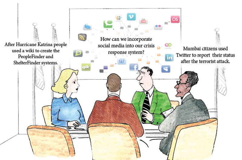
“Can populations self-organize a crisis response? This is a field report on the first two efforts in a continuing series of exercises termed Exercise 24 or X24. These exercises attempted to demonstrate that self-organizing groups can form and respond to a crisis using low-cost social media and other emerging web technologies.”

(READ COMPLETE ARTICLE)

Country / Region Tags: 
Problem, Solution, SitRep, or ?: 

Pages

howdy folks
Page loaded in 0.718 seconds.