Maps - US

Primary tabs

This working group is focused on discussions about maps.

The mission of this working group is to focus on discussions about maps.

Members

Hank Rappaport Kathy Gilbeaux mdmcdonald

Email address for group

maps-us@m.resiliencesystem.org

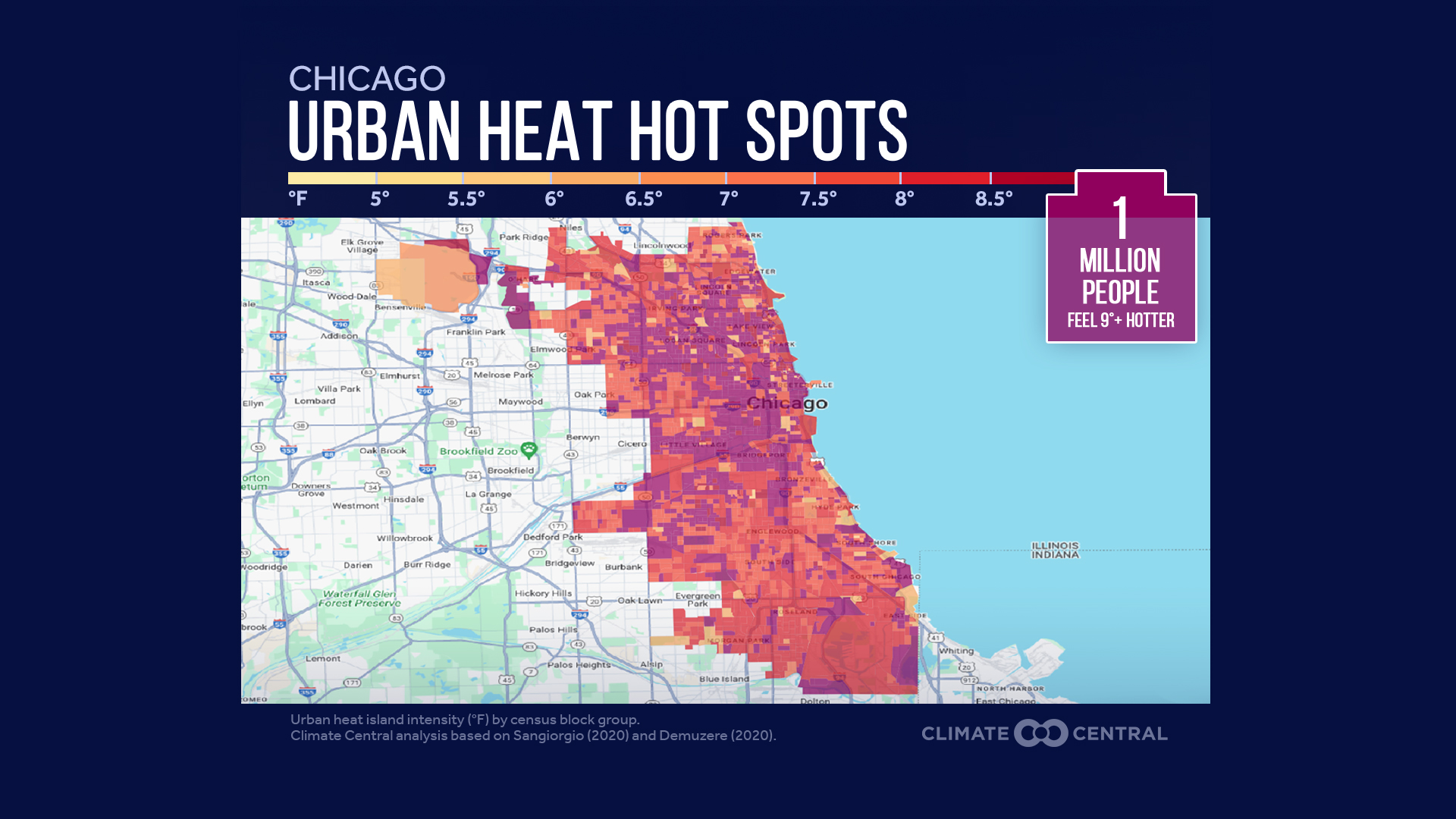
Anaysis of Urban Heat Hot Spots in 65 U.S. Cities


  • The urban heat island (UHI) index was calculated for every census block group within each city to estimate how much hotter these areas are due to the characteristics of the built environment.  

Country / Region Tags: 
Problem, Solution, SitRep, or ?: 

Dengue fever map: Where the mosquito-driven disease is confirmed, spreading fastest in the U.S.


Dengue fever map: Where the mosquito-driven disease is confirmed, spreading fastest

NEXSTAR) – Federal health officials warned doctors around the U.S. this week to look out for signs patients may have dengue fever, a virus spread by mosquitoes that’s surging worldwide. Cases in the U.S. are three times higher than this time last year.

Most of the cases in the U.S. are in people who recently traveled abroad to regions where dengue is spreading quickly. Only one state so far, Florida, has evidence of local transmission, the Centers for Disease Control and Prevention says. U.S. territories Puerto Rico and the Virgin Islands are also seeing local spread of the disease.

..


Country / Region Tags: 
General Topic Tags: 
Problem, Solution, SitRep, or ?: 

The CDC heat and health tracker to help local communities.

Heat poses significant and increasing risks to public health across the United States. Use this dashboard to explore your community’s heat exposure, related health outcomes, and assets that can protect people during heat events.

...

Country / Region Tags: 
Problem, Solution, SitRep, or ?: 

Texas Coastal Areas Will Partially Become Underwater From Sea Level Rise--projects map

Texas Map Shows Where State Will Become Underwater From Sea Level Rise

Coastal areas along Texas's stretch of the Gulf of Mexico could be vulnerable to being consumed by water as sea levels rise due to the effects of climate change, modeling suggests.

By the year 2100, the Intergovernmental Panel on Climate Change (IPCC) estimates there will be between 43 and 84 centimeters (1.4-2.8 feet) of sea level rise, but that an increase of 2 meters (6.6 feet) "cannot be ruled out."

...


Country / Region Tags: 
Problem, Solution, SitRep, or ?: 

California Map Shows Where State Will Become Underwater From Sea Level Rise

Areas of populous cities along California's stretch of the Pacific Ocean could be flooded or entirely consumed by water if, due to the effects of climate change, sea levels rise as predicted, modeling suggests.

Country / Region Tags: 
Problem, Solution, SitRep, or ?: 

Sixteen US States Reported Increased COVID Hospitalizations Before Christmas--CDC map

Sixteen U.S. states had a substantial increase in coronavirus hospitalizations in the week leading up to Christmas compared with the previous seven days, maps from the U.S. Centers for Disease Control and Prevention (CDC) show.

Country / Region Tags: 
Problem, Solution, SitRep, or ?: 

Four Midwest states show highest COVID rates again

...

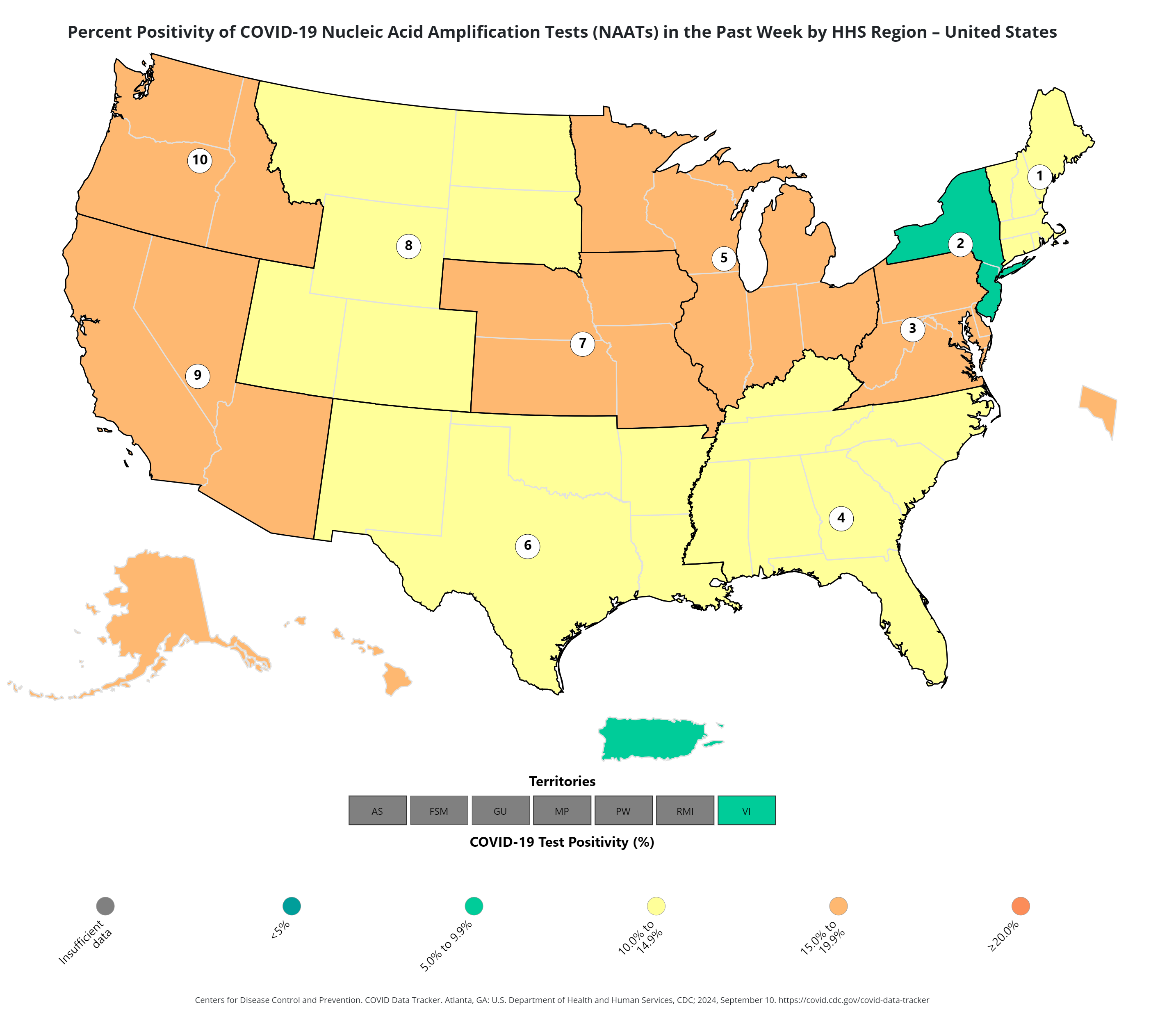
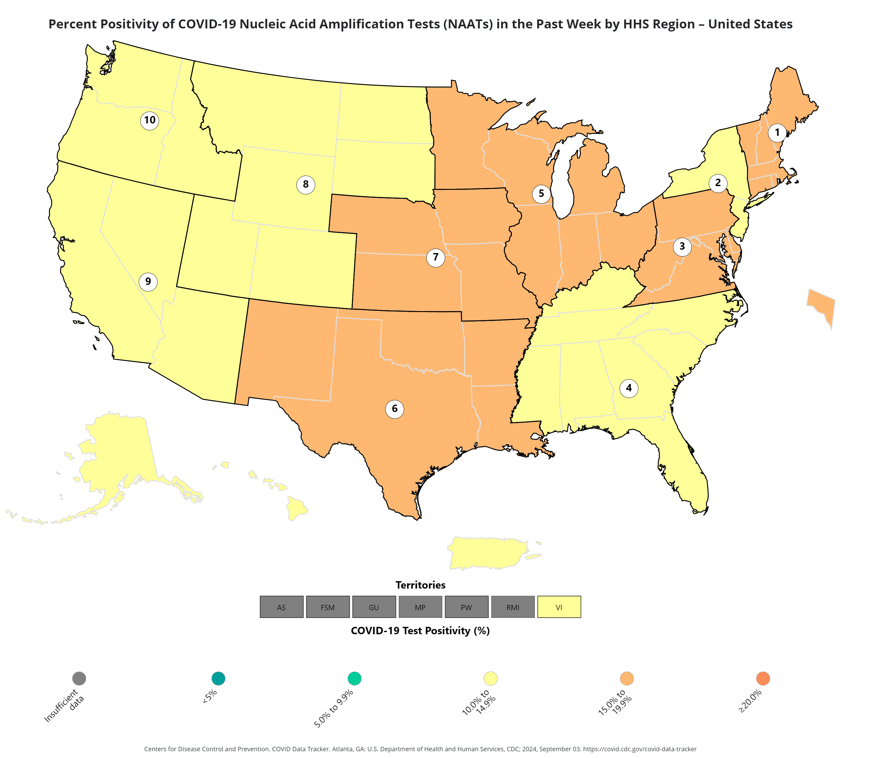
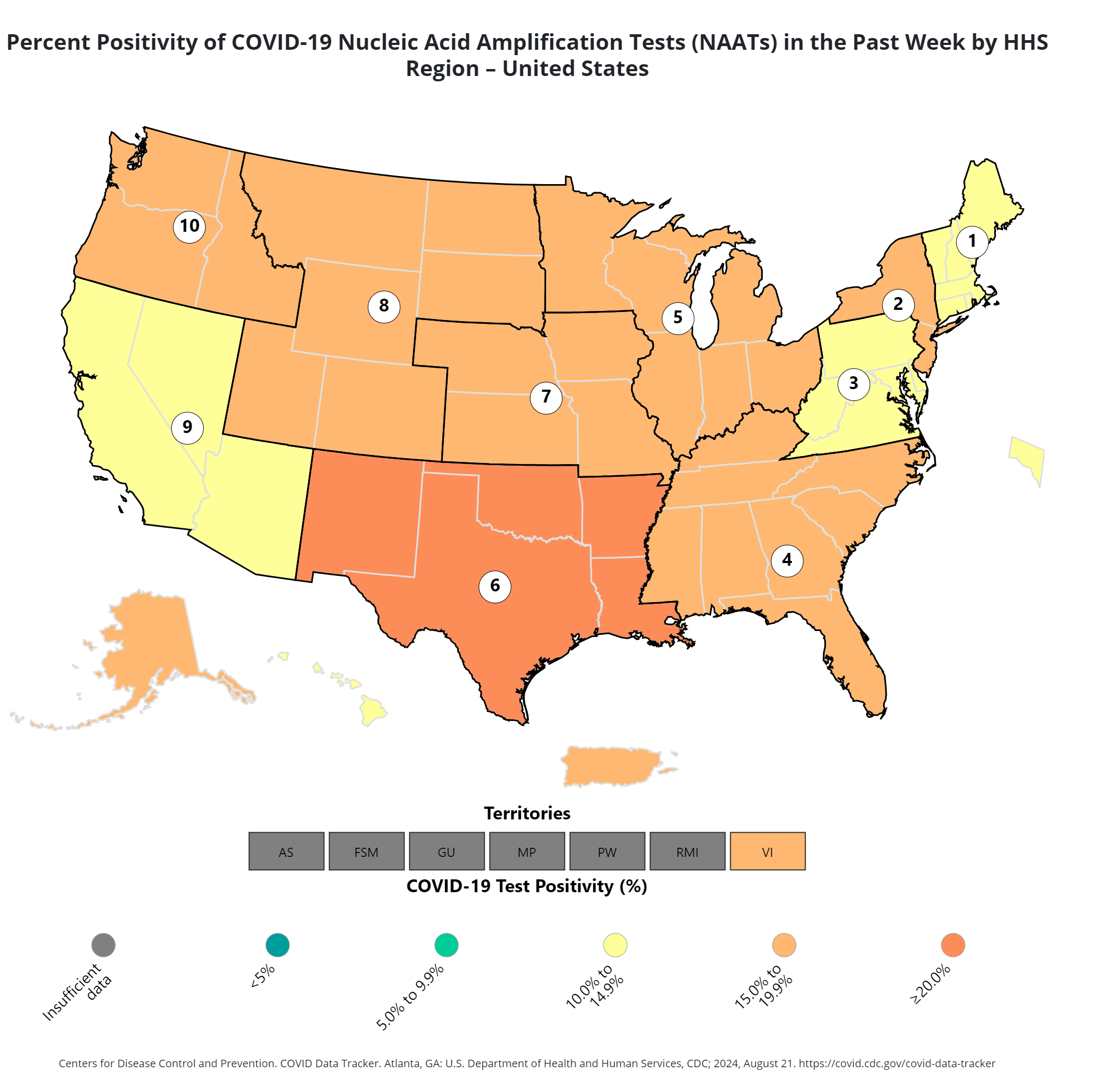
In only four states in the entire country the rate was above 15 percent. Region Seven, which includes Iowa, Kansas, Missouri and Nebraska, had the highest rate in the country as of the week ending on December 16, 18.5 percent. For weeks the four states have been identified as the worst-hit by the virus in the country, with more people testing positive than anywhere else.

Problem, Solution, SitRep, or ?: 

Map Shows 4 US States With Highest Positive Cases--CDC


New data shows that people living in four states are still suffering the highest levels of COVID-19 infections in the country, according to the Centers for Disease Control and Prevention (CDC).

Iowa, Kansas, Missouri, and Nebraska remain the worst-hit states as more people there have been diagnosed positive for the virus than elsewhere in the country.

...

Country / Region Tags: 
Problem, Solution, SitRep, or ?: 

Four U.S. states show highest nmber of Covid positive cases


...

Region Seven—an administrative area consisting of Iowa, Missouri, Kansas, and Nebraska—is once again at the top of this chart as it has the highest proportion of COVID-19 diagnoses following testing. That region saw the most cases out of the entire U.S. in last week's figures, too.

...


Country / Region Tags: 
Problem, Solution, SitRep, or ?: 

Pages

howdy folks
Page loaded in 0.820 seconds.