Weather - US

Primary tabs

This working group is focused on discussions about weather events.

The mission of this working group is to focus on discussions about weather events.

Members

Amanda Cole Kathy Gilbeaux mdmcdonald tkm

Email address for group

weather-us@m.resiliencesystem.org

Search for Survivors Begins After Massive Oklahoma tornado

cbsnews.com - May 20, 2013

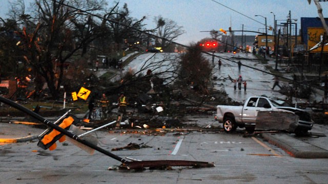
OKLAHOMA CITY - A mix of volunteers and first responders began combing through debris in the Oklahoma City area Monday evening to look for survivors after neighborhoods were flattened by a mile-wide tornado.

The National Weather Service says the devastating twister, one of several created by a storm system that swept through nation's midsection the past 36 hours, reached winds up to 200 mph.

Television footage on Monday afternoon showed homes and buildings that had been reduced to rubble in Moore, Okla., south of Oklahoma City.

(READ COMPLETE ARTICLE)

National Weather Service Roadmap 2.0 Leads the Way to a Weather-Ready Nation


nws.noaa.gov - April 24, 2013

On April 24, 2013, NOAA’s National Weather Service, in partnership with the National Weather Service Employees Organization (NWSEO), released The Weather-Ready Nation Roadmap 2.0.  The updated Roadmap blends an understanding of social and physical sciences and lends itself to building community resilience in the face of increasing vulnerability to extreme weather and water events. After achieving the goals of the Weather-Ready Nation Roadmap, NWS will empower emergency managers, first responders, government officials, businesses, and the public to make faster, smarter decisions to save lives and protect livelihoods.

“The NWS recognizes that issuing excellent forecasts and warnings may not always be enough to save lives,” said NWS Director Louis W. Uccellini.  “The Weather-Ready Nation initiative is first and foremost to save lives and protecting livelihoods by providing useful, relevant, actionable information on for critical decision support services.”

Massive Midwest Floods

The Associated Press - April 23, 2013

PEORIA HEIGHTS, Ill. — More rain on Tuesday was the last thing flood fighters across the Midwest wanted to see, adding more water to swollen rivers that are now expected to remain high into next month.

A duck swims a window, viewed from inside Anderson Eye Care at the Riverfront Plaza Building in downtown Grand Rapids, Mich., as The Grand River crests on Monday, April 22, 2013, at an all time high of 21.85 feet, a full 2.2 feet above the record set in 1985, in downtown Grand Rapids. Previous water levels can be seen marked on the wall.

Local Warming: US Cities in Front Line as Sea Levels Rise


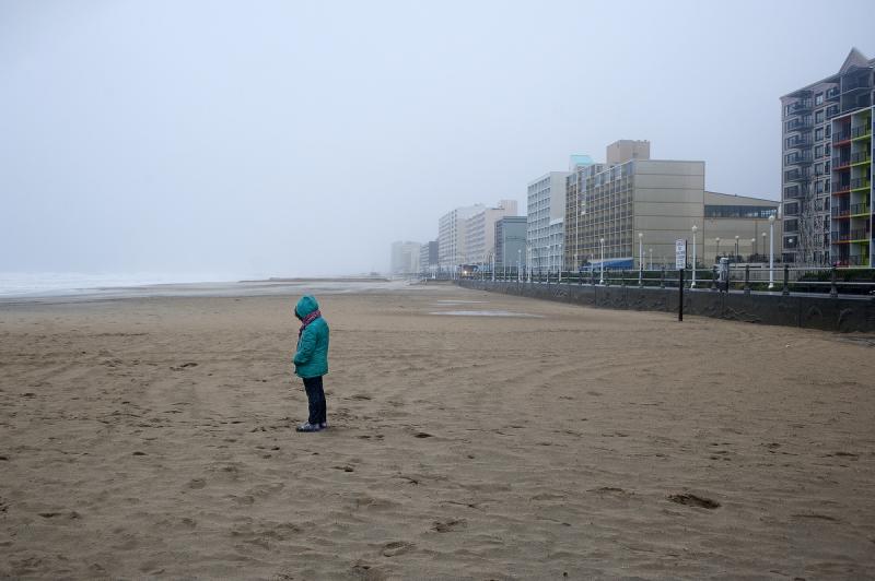
A beachgoer along the oceanfront observes the effects of high wind and heavy rain as Hurricane Sandy begins to arrive in Virginia Beach, Virginia, October 28, 2012.  Credit: Reuters/Rich-Joseph Facun

reuters.com - by Deborah Zabarenko - February 27, 2013

(Reuters) - The signs of rising water are everywhere in this seaport city: yellow "Streets May Flood" notices are common at highway underpasses, in low-lying neighbourhoods and along the sprawling waterfront.

Built at sea level on reclaimed wetland, Norfolk has faced floods throughout its 400-year history. But as the Atlantic Ocean warms and expands, and parts of the city subside, higher tides and fiercer storms seem to hit harder than they used to.

Dealing with this increased threat has put Norfolk at the forefront of American cities taking the lead on coping with intense weather, from floods to droughts to killer heat, without waiting for the federal government to take the lead.

(READ COMPLETE ARTICLE)

Making Communities More Resilient to Climate-Induced Weather Disasters

submitted by Samuel Bendett

homelandsecuritynewswire.com - February 18, 2013

Mounting scientific evidence indicates climate change will lead to more frequent and intense extreme weather that affects larger areas and lasts longer. We can reduce the risk of weather-related disasters, however, with a variety of measures. Experts say that a good strategy should include a variety of actions such as communicating risk and transferring it through vehicles such as insurance, taking a multi-hazard management approach, linking local and global management, and taking an iterative approach as opposed to starting with a master plan.

(READ COMPLETE ARTICLE)

Country / Region Tags: 
Problem, Solution, SitRep, or ?: 

Mississippi Emergency Management Agency (MEMA) Updates Reports from Tornado Damage

(U.S. RESILIENCE SYSTEM MEMBERS ARE ASSISTING WITH RELIEF EFFORTS FOR THIS DISASTER THROUGH THE ADMINISTRATION OF A FACEBOOK PAGE TITLED "HATTIESBURG, MS TORNADO - DO YOUR PART".  CLICK HERE TO GO TO THE "HATTIESBURG, MS TORNADO - DO YOUR PART" FACEBOOK PAGE.)       


Hardy Street in front of the University of Southern Mississippi campus is obstructed by debris blown by an apparent tornado in Hattiesburg, Miss., Sunday, Feb. 10, 2013. (AP Photo/The Student Printz, Jana Edwards)

hattiesburgamerican.com - February 11, 2013

The Mississippi Emergency Management Agency has received reports of damage from nine counties as a result of severe weather that moved through the state on Sunday.There were at least 63 injuries, two critical and the rest minor. There are no reported deaths.

(READ COMPLETE ARTICLE)

"Back to the Drawing Board" Advancement by Several Forecasting Experts (NOAA release)

The following is a National Oceanic and Atmospheric Administration (NOAA) release.
Article submitted by Henry Rodriguez

www.noaa.gov

 In case Superstorm Sandy did not convince risk experts that hurricane categories are not useful predictors of potential storm surge levels, a NOAA executive hammered home the point at a recent insurance conference.

ALERT - Mayor Announces Mandatory Evacuation of Four Health Care Facilities in the Rockaways

nycgov.tumblr.com

This evening, November 6th, 2012, Mayor Bloomberg issued mandatory evacuation orders for four health care facilities in the Rockaways:

  • Park Nursing Home (181 residents)
  • Ocean Promenade Nursing Center (91 residents)
  • Peninsula Center for Extended Care and Rehabilitation (180 residents)
  • Surfside Manor Home for Adults (173 residents)

The facilities are in the most heavily-impacted area of the Rockaways and have been successfully operating on generator power. The impending Nor’easter storm surge could compromise the facilities’ generators, putting the elderly residents at risk. All facilities will be evacuated tonight to protect the health and safety of residents and staff.

http://nycgov.tumblr.com/post/35162642365/mayor-announces-mandatory-evacuation-of-four-health

https://twitter.com/nycgov/status/265994702581547008

U.S. Satellite Plans Falter, Imperiling Data on Storms

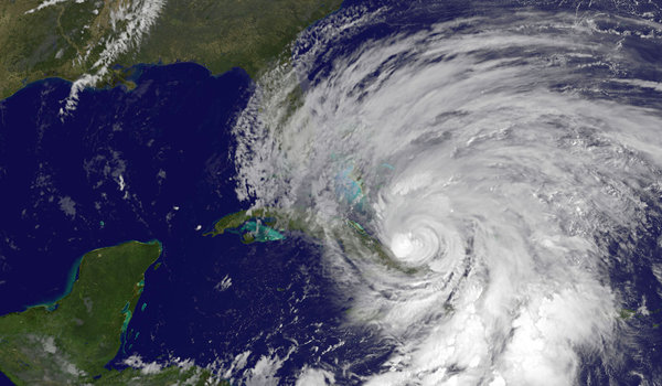
A NASA satellite image shows Hurricane Sandy battering the Caribbean on Thursday.

Image: A NASA satellite image shows Hurricane Sandy battering the Caribbean on Thursday. (Agence France-Presse — Getty Images)

nytimes.com - October 26th, 2012 - John H. Cushman Jr.

The United States is facing a year or more without crucial satellites that provide invaluable data for predicting storm tracks, a result of years of mismanagement, lack of financing and delays in launching replacements, according to several recent official reviews.

 The looming gap in satellite coverage, which some experts view as almost certain within the next few years, could result in shaky forecasts about storms like Hurricane Sandy, which is expected to hit the East Coast early next week.

The endangered satellites fly pole-to-pole orbits and cross the Equator in the afternoon, scanning the entire planet one strip at a time. Along with orbiters on other timetables, they are among the most effective tools used to pin down the paths of major storms about five days ahead.

Pages

howdy folks
Page loaded in 0.726 seconds.