You are here

Communication

Primary tabs

The Communication Working Group is focused on communication improving health and human security status in the U.S.

The mission of the Communication working group is to optimize the health, human security, resilience, and sustainability of Americans and their communities of interest globally. 

Members

bevcorwin Kathy Gilbeaux Maeryn Obley mdmcdonald

Email address for group

communication@m.resiliencesystem.org

Using Twitter to Share Information After a Disaster

submitted by Luis Kun

Homeland Security News Wire - May 23, 2012

A study from North Carolina State University shows how people used Twitter following the 2011 nuclear disaster in Japan, highlighting challenges for using the social media tool to share information. The study also indicates that social media have not changed what we communicate so much as how quickly we can disseminate it.

“I wanted to see if Twitter was an effective tool for sharing meaningful information about nuclear risk in the wake of the disaster at the Fukushima Daiichi nuclear plant,” says Dr. Andrew Binder, an assistant professor of communication at NC State and author of a paper describing the work. “I knew people would be sharing information, but I wanted to see whether it was anecdotal or substantive, and whether users were providing analysis and placing information in context.

“In the bigger picture, I wanted to see whether social media is changing the way we communicate, or if we are communicating the same way using different tools.”

Researchers Use GPS Data to Speed Up Tsunami Warnings


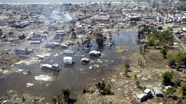
In this Jan. 2, 2005 file photo, a wide area of destruction is shown from an aerial view taken over Meulaboh, 250 kilometers (156 Miles) west of Banda Aceh, Indonesia. Researchers in the United States are hoping to use GPS data to speed up current warnings. (AP Photo/Dita Alangkara, File)

U.S. seismologists currently testing new warning system

by Andrew Pinsent - CBC News - May 5, 2012

Scientists in the United States have been testing an advanced tsunami warning system using GPS data, combined with traditional seismology networks, to attempt to detect the magnitude of an earthquake faster so warnings of potential tsunamis can get out to potentially affected areas sooner.

The prototype is called California Integrated Seismic Network (CISN), and is a collaboration between the United States Geological Survey (USGS) and The Gordon and Betty Moore Foundation, whose focus is on environmental conservation.

Country / Region Tags: 
Problem, Solution, SitRep, or ?: 

The City as Lab: 21 Metropoles Prepare to Prototype

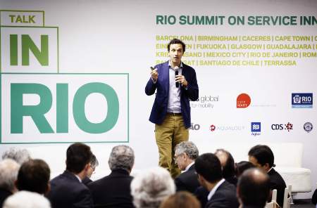
Living Labs Global co-founder Sascha Haselmayer addresses the crowd in Rio de Janeiro

submitted by Albert Gomez

good.is - by Zak Stone - May 4, 2012

In a megapolis like Mexico City, any planning initiative that moves citizens from cars to busses will pay off in reductions to traffic and air pollution. A major deterrent to using public transportation in the city? Comfort, according to Dr. Julio Mendoza, director of Mexico City's Institute of Science and Technology. Many would rather drive than experience that particular breed of public transportation-pegged anxiety: waiting helplessly on the street corner for a bus that feels like it won't ever arrive.

After participating in the Living Labs Global Award program, a competition designed to help cities solve planning challenges, the Mexican capital may have found a fix. In February, Mexico City and 20 other LLGA participants around the world put out an open call to companies to pitch solutions to important but fixable problems.

Country / Region Tags: 
Problem, Solution, SitRep, or ?: 

Volunteers Creating Change: 6th Annual Disaster Volunteer Conference - May 1, 2012

On Tuesday, May 1, at  one of New York City's premier auditoriums, Pace University's Michael Schimmel Center for the Arts in lower Manhattan, the NYC Citizen Corps Council will be hosting the 6th annual Disaster Volunteer Conference, Volunteers Creating Change.  Enjoy the exhibits, dinner provided by The Salvation Army Greater New York Division, and an educational conference with fellow volunteers.  The conference’s distinguished speakers will include a welcome address by Joseph F. Bruno (Commissioner – NYC Office of Emergency Management), a keynote address by Jeff Parness (Founder and Executive Director – New York Says Thank You Foundation), followed by a panel discussion moderated by Herman Schaffer, MSW (Director, Community Outreach – NYC Office of Emergency Management) with a growing list of panelists, including Gary Bagley (Executive Director – New York Cares) and Sara Farmer (Data Humanitarian – Standy-by Task force, Crisismappers Network, and Ushahidi Community).  For additional information and to register, visit www.NYC.gov/citizencorps.

Exercise 24: Using Social Media for Crisis Response

submitted by Samuel Bendett


worldfinancialreview.com - By George H. Bressler, Murray E. Jennex & Eric G. Frost

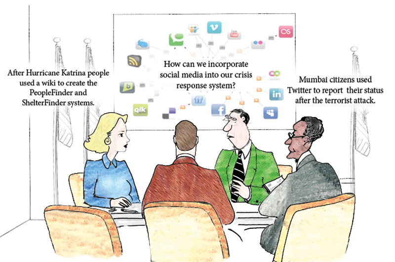
“Can populations self-organize a crisis response? This is a field report on the first two efforts in a continuing series of exercises termed Exercise 24 or X24. These exercises attempted to demonstrate that self-organizing groups can form and respond to a crisis using low-cost social media and other emerging web technologies.”

(READ COMPLETE ARTICLE)

Country / Region Tags: 
Problem, Solution, SitRep, or ?: 

California Struggling to Prepare Quake Early Warning System

submitted by Samuel Bendett


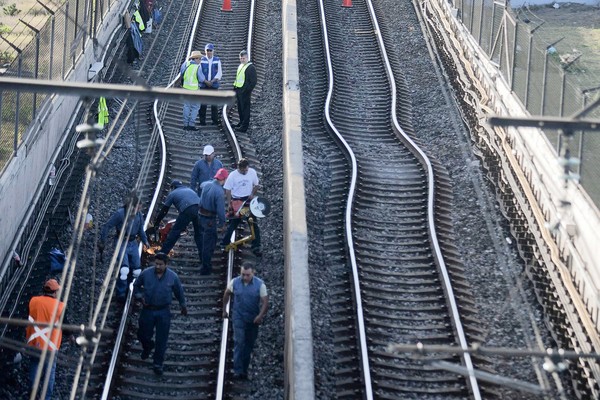
Workers fix subway lines that were damaged after an earthquake was felt in Mexico City on Tuesday, March 20. (Associated Press / March 19, 2012)

By Hector Becerra and Sam Allen, Times Staff Writers - latimes.com - March 22, 2012

The state spends a fraction of what countries like Mexico and Japan spend on their systems. One reason for the lack of interest, experts say, is that California has not experienced a catastrophic quake in more than a century.

Predicting Locations of Emergency & Damage During Disaster Using VGI Data

submitted by Alister Wm Macintyre

                                                     (CLICK ON IMAGE BELOW - TO ENLARGE)


ushahidi.com - by Prateek Budhwar

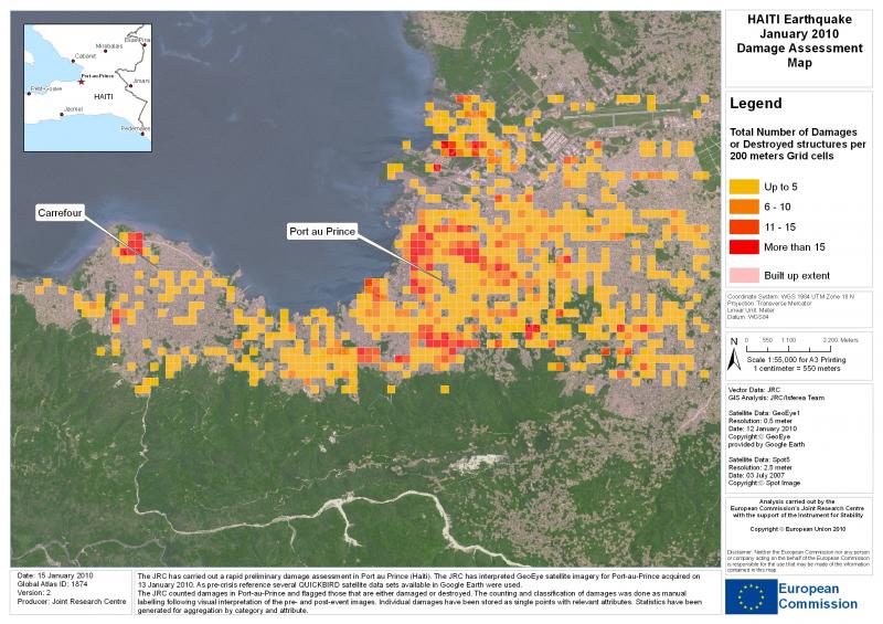
The VGI data obtained from the Ushahidi-Haiti platform during the first 72 hours of Earthquake in Haiti can be used for predicting the locations of ‘Emergency and damaged areas’ using Ushahidi Reports in Port-au-Prince. Two rapid and very successful VGI deployments helped coordinate disaster response after a devastating magnitude 7 earthquake struck Haiti in January 2010.

OpenStreetMap (OSM) project volunteers working outside Haiti created a digital street map of Port-au-Prince and other places in Haiti very rapidly using fine-resolution imagery to trace vector maps of streets and other features.

(READ COMPLETE ARTICLE)

Country / Region Tags: 
Problem, Solution, SitRep, or ?: 

Saratoga Hospitals Deploy Biometrics to Increase Security and Improve Efficiency

submitted by Luis Kun

Homeland Security News Wire - March 13, 2012

To improve privacy and security measures, Saratoga Hospital in New York recently announced that it would be partnering with DigitalPersona Inc. to install biometric access controls to verify medical personnel’s identities and increase efficiency.

Saratoga Hospitals operates five remote care facilities in New York where it employs more than 1,700 doctors, nurses, and staff members. Due to the awkward username and password authentication process, hospital officials say they had difficulty accurately tracking access to its sensitive data networks.

We needed a solution that would encourage our staff to comply with our access control policies without limiting their ability to treat patients and be productive,” explained Gary Moon, Saratoga Hospital’s information systems security analyst, in an interview with InformationWeek Healthcare. “Passwords can be cumbersome, and oftentimes the staff would stay logged in to avoid having to manually type a password each time they needed to access patient information. Thus, we could not track who had accessed information.”

New Facebook Feature Lets You Mark Yourself as ‘Safe’ After Major Disaster

submitted by Samual Bendett

techland.time.com - by Keith Wagstaff - February 29, 2012

In the wake of a disaster, one of the most terrifying things is not knowing if your loved ones are safe. Contact can be difficult: Landlines can go down and cellphones can lose their charge. Even if you call your mother and tell her you’re safe, you still have a large network of friends and family that might still be worried about you.

That’s why Facebook’s new Disaster Message Board makes sense. Right now it’s only being tested in Japan, which is still dealing with the aftermath of the Fukushima disaster.

(READ COMPLETE ARTICLE)

Tornado Victims Flock to Facebook for Helping Hand


Student Madeline Evans walks past a destroyed school bus after a tornado devastated the town of Henryville, Indiana, March 3, 2012.  Credit: Reuters/Indiana National Guard/Sgt. John Crosby

by Mary Slosson - March 5, 2012

(Reuters) - Residents of the storm-ravaged communities in the Midwest are reaching out to each other, neighbor to neighbor, through social media sites to coordinate disaster relief and share information.

A chain of fast-moving tornadoes spawned by massive thunderstorms cut a swath of destruction from the Midwest to the Gulf of Mexico on Friday, killing at least 39 people and leaving many residents homeless and seeking food, clothing, and shelter.

With phone connections spotty as emergency workers tried to repair downed power lines and clear debris, Facebook pages -- accessible by cell phone, mobile device, or computer -- have proven a go-to source for communities to assist one another.

(READ COMPLETE ARTICLE)

Pages

howdy folks
Page loaded in 0.703 seconds.