You are here

Disaster Risk Reduction

WorldRiskReport 2011

submitted by Joyce Fedeczko
 
 
WorldRiskReport 2011
September 9, 2011 21:39
Source: United Nations University
 
Country / Region Tags: 
Problem, Solution, SitRep, or ?: 

Under NYC's Streets, Power Lines Stayed Safe


Photograph by Eduardo Munoz, Reuters

AP Business Writers - by Jonathan Fahey and Peter Svensson - August 28, 2011

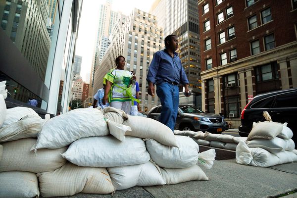
NEW YORK (AP) -- Below the streets of New York City, a network of pipes, cables and tunnels up to 200 feet deep transports power, gas, water, Internet traffic, trains, sewage and more. When Hurricane Irene hit the city Sunday, this underground network was largely protected from major damage.

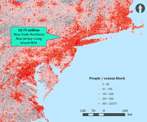
On the island of Manhattan, only a handful of its 1.6 million residents lost power. And roughly 50,000 households in the city's outer boroughs of the Bronx, Brooklyn, Queens and Staten Island lost power.

Elsewhere, Irene left millions of East Coast residents without power, as winds knocked trees into above-ground power lines.

But while the city's buried infrastructure is safe from wind, it is vulnerable to flooding. Some experts say the city simply got lucky that the flooding wasn't more severe. The subway system is especially at risk, which is why transportation officials preemptively shut it down.

Country / Region Tags: 
Problem, Solution, SitRep, or ?: 

Grand Central Station NYC 27-28 August

Central Station NYC 8.27-28

PHOTO: Metropolitan Transportation Authority of the State of New York

US Northeast Megacity (in the path of Hurricane Irene)

Megacity region US Northeast

US Northeast Megacity population map displayed by census block data.

New York Times interactive Map of Hurricane Irene's path (Click on image)

NOTE: as of Saturday afternoon, state and utility reports from North Carolina and Virgina report 1 million power customers were without electricity.

State-by-State Developments Related to Hurricane Irene

CNN - August 26, 2011 - 8:44 p.m. EDT

(CNN) -- On Friday, President Barack Obama said of Hurricane Irene that "all indications point to this being a historic hurricane."

Numerous local, state and federal agencies, among other organizations, have taken steps in preparation. Here are some of those measures, for states most affected by Hurricane Irene:

SOUTH CAROLINA

Irene was off the South Carolina coast on Friday, with its outer bands bringing gusty winds, heavy rain and dangerous surf.

No evacuations were ordered, as the storm path appears to be too far east to present serious problems. However, state emergency officials were monitoring Irene and have contingency plans. The state emergency management agency is using its website, Twitter, Facebook and YouTube to keep the public informed.

NORTH CAROLINA

Hurricane Irene is expected to make its first contact with the U.S. mainland on Saturday morning near Beaufort, according to CNN meteorologist Sean Morris.

Hurricane Irene Moves North, FEMA Sets Expectations

The Washington Post - August 25, 2011


Hurricane Irene appears headed towards the Mid-Atlantic and New England regions this weekend — areas that haven’t endured tropical storm-force winds and rain in years.

And the Federal Emergency Management Agency, panned by Southerners almost six years ago for its inept response to Hurricane Katrina, is reminding Americans up north that they should turn first to local and state authorities in advance of the storm.

“If the public’s seeing FEMA, it’s most likely if we’ve had impacts and we have requests for assistance,” the agency’s administrator, Craig Fugate , told reporters Thursday. “Otherwise, we’re doing things to get ready, but we’re not getting in front of the governor’s teams, we’re there to support them.”

Hurricane Irene - Resources for Preparedness and Recovery


(Additional Resources are available by clicking on "Read more" at the bottom of this post.  This list will be updated periodically.)

Citizen Command Center Relief Database (Searchable by State)

http://www.citizencommandcenter.org/conditions/list?state=All

NOAA - National Weather Service - Graphical Hurricane Local Statements

http://www.weather.gov/ghls/

NOAA - National Weather Service - Hurricane Local Statements (that have been released within the last 12 hours)

http://www.nhc.noaa.gov/text/index_hls4.shtml

U. S. Department of Health and Human Services - Public Health Emergency - Hurricane Irene: Northeast

http://www.phe.gov/emergency/events/irene/Pages/northeast.aspx

NOAA - Tides Online - High Water Condition - Hurricane Irene

http://tidesonline.nos.noaa.gov/advisory.html

Researchers Develop Controversial Earthquake Detection Network

Homeland Security Newswire - August 18, 2011


A QuakeFinder network installation // Source: newsvine.com

Researchers at a Silicon Valley company are hard at work developing an experimental network of electromagnetic sensors that could predict large earthquakes as much as two weeks in advance; the theory behind the research is disputed, but Tom Bleier, the inventor and chief engineer behind project QuakeFinder, hopes to prove seismologists wrong.

Researchers at a Silicon Valley company are hard at work developing an experimental network of electromagnetic sensors that could predict large earthquakes as much as two weeks in advance.

The theory behind the research is disputed, but Tom Bleier, the inventor and chief engineer behind project QuakeFinder, hopes to prove seismologists wrong. Under the project, engineers will install roughly 200 five-foot tall sensors near fault lines in California to measure changes in underground magnetic fields and to detect electrically charged particles in the air.

Country / Region Tags: 
Problem, Solution, SitRep, or ?: 

How Risk Perceptions Influence Evacuations From Hurricanes

submitted by Joyce Fedeczko

http://web.docuticker.com/go/docubase/64807

August 5, 2011 23:09

Source: James A. Baker III Institute for Public Policy
From the catalog description:
This study shows that people are more sensitive to overall perceived hurricane-related hazards than they are to individual risk types. Emergency managers can use this information to achieve greater compliance to emergency government directives and evacuations.

+Direct link to document (PDF; 806.2 KB) - http://bakerinstitute.org/publications/POL-pub-SteinHurricaneRiskPerception-080311.pdf

Country / Region Tags: 
Problem, Solution, SitRep, or ?: 

Averting Bridge Disasters: New Sensors Could Save Hundreds of Lives

submitted by Samuel Bendett

Homeland Security Newswire - August 1, 2011


Sensor mounted to bridge member // Source: gizmag.com

One of every four U.S. highway bridges has known structural problems or exceeded its intended life-span. Most only get inspected once every one or two years; University of Maryland researcher has developed a new sensor that measures indicators of a bridge's structural health, such as strain, vibration, flexibility, and development of metal cracks; the sensors are expected to last more than a decade, with each costing about $20

Millions of U.S. drivers cross faulty or obsolete bridges every day, highway statistics show, but it is too costly to fix all these spans or adequately monitor their safety, says a University of Maryland researcher who has developed a new, affordable early warning system.

This wireless technology could avert the kind of bridge collapse that killed thirteen and injured 145 along Minneapolis’ I-35W on 1 August 2007, he says — and do so at one-one-hundredth the cost of current wired systems.

Country / Region Tags: 
Problem, Solution, SitRep, or ?: 

Pages

Subscribe to Disaster Risk Reduction
howdy folks