You are here

Disaster Management

Primary tabs

This working group is focused on discussions about disaster management.

The mission of this working group is to focus on discussions about disaster management.

Members

Kathy Gilbeaux Maeryn Obley mdmcdonald

Email address for group

disaster-management@m.resiliencesystem.org

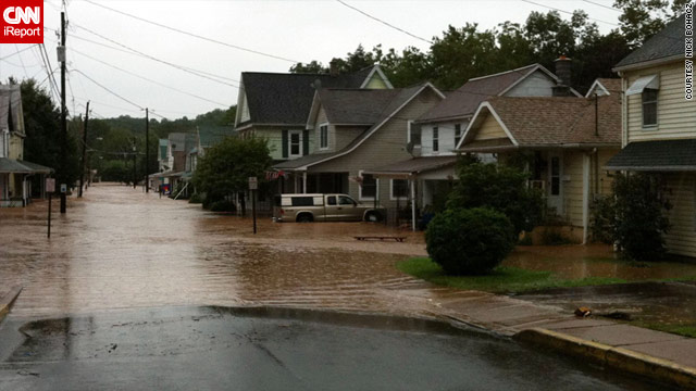
State-by-State Developments Related to Hurricane Irene

CNN - August 26, 2011 - 8:44 p.m. EDT

(CNN) -- On Friday, President Barack Obama said of Hurricane Irene that "all indications point to this being a historic hurricane."

Numerous local, state and federal agencies, among other organizations, have taken steps in preparation. Here are some of those measures, for states most affected by Hurricane Irene:

SOUTH CAROLINA

Irene was off the South Carolina coast on Friday, with its outer bands bringing gusty winds, heavy rain and dangerous surf.

No evacuations were ordered, as the storm path appears to be too far east to present serious problems. However, state emergency officials were monitoring Irene and have contingency plans. The state emergency management agency is using its website, Twitter, Facebook and YouTube to keep the public informed.

NORTH CAROLINA

Hurricane Irene is expected to make its first contact with the U.S. mainland on Saturday morning near Beaufort, according to CNN meteorologist Sean Morris.

Hurricane Irene Moves North, FEMA Sets Expectations

The Washington Post - August 25, 2011


Hurricane Irene appears headed towards the Mid-Atlantic and New England regions this weekend — areas that haven’t endured tropical storm-force winds and rain in years.

And the Federal Emergency Management Agency, panned by Southerners almost six years ago for its inept response to Hurricane Katrina, is reminding Americans up north that they should turn first to local and state authorities in advance of the storm.

“If the public’s seeing FEMA, it’s most likely if we’ve had impacts and we have requests for assistance,” the agency’s administrator, Craig Fugate , told reporters Thursday. “Otherwise, we’re doing things to get ready, but we’re not getting in front of the governor’s teams, we’re there to support them.”

Researchers Develop Controversial Earthquake Detection Network

Homeland Security Newswire - August 18, 2011


A QuakeFinder network installation // Source: newsvine.com

Researchers at a Silicon Valley company are hard at work developing an experimental network of electromagnetic sensors that could predict large earthquakes as much as two weeks in advance; the theory behind the research is disputed, but Tom Bleier, the inventor and chief engineer behind project QuakeFinder, hopes to prove seismologists wrong.

Researchers at a Silicon Valley company are hard at work developing an experimental network of electromagnetic sensors that could predict large earthquakes as much as two weeks in advance.

The theory behind the research is disputed, but Tom Bleier, the inventor and chief engineer behind project QuakeFinder, hopes to prove seismologists wrong. Under the project, engineers will install roughly 200 five-foot tall sensors near fault lines in California to measure changes in underground magnetic fields and to detect electrically charged particles in the air.

Country / Region Tags: 
Problem, Solution, SitRep, or ?: 

Communicating With the Public During Emergencies: An Update on Federal Alert & Warning Efforts

submitted by Mike Kraft


Testimony of Damon Penn, Assistant Administrator, National Continuity Programs, Before the House Committee on Homeland Security, "Communicating With the Public During Emergencies: An Update on Federal Alert & Warning Efforts"

dhs.gov - Release Date: July 8, 2011 - Washington, D.C.

Introduction

Country / Region Tags: 
General Topic Tags: 
Problem, Solution, SitRep, or ?: 

Video - Crisis Mapping Helps with Disaster Relief

Country / Region Tags: 
Problem, Solution, SitRep, or ?: 

Crisis Mapping Helps with Disaster Relief

Voice of America - June 30, 2011

After devastating natural disasters, mobile phone networks, satellites and other computer software are often used to help to pinpoint where help is needed the most.  They are crucial for the creation of crisis maps.

The power of the mobile phone and other social media became clear in the aftermath of the tsunami and earthquake in Japan.  Just hours after disaster struck, Japanese volunteers used social media information  to create a crisis map.  The map indicated hazardous areas and emergency services.  Hundreds of people each day posted updates to the map on the Internet, including information from radio stations.

Crisis maps also helped with relief efforts in Haiti. Thousands of text messages provided information to international aid organizations about shelter, food supplies and sanitation.  A mapping team helped pinpoint search and rescue requests for people trapped in the rubble.

Sheldon Himelfarb is the director of peacebuilding at the U.S. Institute of Peace in Washington. "The word went out that if you texted a certain short code number with your call for help, it would be captured, mapped and it would enable responders to help… We saw very quickly how the emergency responders of all sorts, from the Red Cross to the military to the NGOs started to rely on this map," Himelfarb said.

Country / Region Tags: 
Problem, Solution, SitRep, or ?: 

Pages

howdy folks