You are here

Maps - US

Primary tabs

This working group is focused on discussions about maps.

The mission of this working group is to focus on discussions about maps.

Members

Hank Rappaport Kathy Gilbeaux mdmcdonald

Email address for group

maps-us@m.resiliencesystem.org

A Picture of Detroit Ruin, Street by Forlorn Street


Leonard Patterson took a picture of a parcel of land on Detroit’s northwest side earlier this month as part of an emerging database. Credit Fabrizio Costantini for The New York Times

nytimes.com - by Monica Davey - February 17, 2014

DETROIT — A midnight blue Chevy rolls slowly down a snow-covered street, an emergency strobe light on its roof and a sign on its side that promises this is “official business.” At each house, business, even vacant lot, workers in the car pause to decide whether someone lives there and what shape the place is in before snapping a photo and beaming it to “mission control” miles away.

All over Detroit, scores of these workers — on some days as many as 75 three-person teams — have been wending their way through the streets since December, cataloging on computer tablets one of this bankrupt city’s most devastating ailments: its tens of thousands of abandoned and dilapidated buildings.

(READ COMPLETE ARTICLE)

Country / Region Tags: 
General Topic Tags: 
Problem, Solution, SitRep, or ?: 

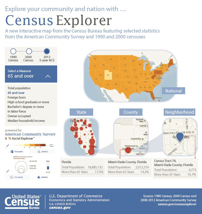
Census Bureau Introduces New Interactive Mapping Tool along with Latest American Community Survey Statistics

census.gov- December 17, 2013

The U.S. Census Bureau released Census Explorer, a new interactive mapping tool that gives users easier access to neighborhood level statistics. The mapping tool uses updated statistics from the 2008-2012 American Community Survey (ACS), which were also released today.

The new application allows users to map out different social, economic and housing characteristics of their state, county or census tract, and to see how these areas have changed since the 1990 and 2000 censuses. The mapping tool is powered by American Community Survey statistics from the Census Bureau's API, an application programming interface that allows developers to take data sets and reuse them to create online and mobile apps.

(READ COMPLETE ARTICLE)

Country / Region Tags: 
General Topic Tags: 
Problem, Solution, SitRep, or ?: 

Pages

howdy folks
Page loaded in 0.529 seconds.