You are here

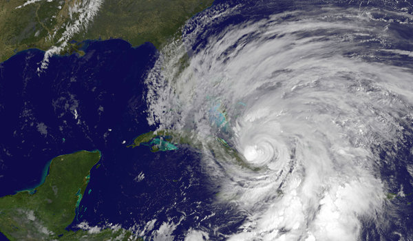
Image: A NASA satellite image shows Hurricane Sandy battering the Caribbean on Thursday. (Agence France-Presse — Getty Images)
nytimes.com - October 26th, 2012 - John H. Cushman Jr.
The United States is facing a year or more without crucial satellites that provide invaluable data for predicting storm tracks, a result of years of mismanagement, lack of financing and delays in launching replacements, according to several recent official reviews.
The looming gap in satellite coverage, which some experts view as almost certain within the next few years, could result in shaky forecasts about storms like Hurricane Sandy, which is expected to hit the East Coast early next week.
The endangered satellites fly pole-to-pole orbits and cross the Equator in the afternoon, scanning the entire planet one strip at a time. Along with orbiters on other timetables, they are among the most effective tools used to pin down the paths of major storms about five days ahead.


Recent Comments